Kamikochi Mountain Climbing, Trekking, and Hiking Guide! A Comprehensive Guide to Day Trips, Beginner-Friendly Tours, What to Wear, and the Best Times to Visit
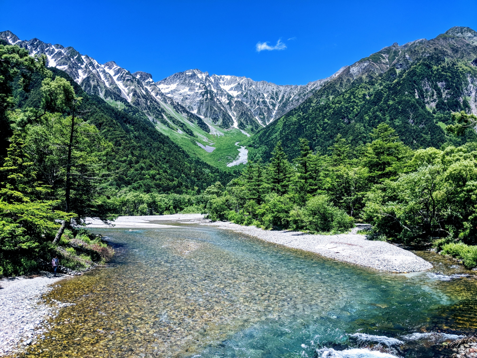
Mountain Climbing, Trekking, and Hiking in Kamikochi
A Comprehensive Guide to Day Trips and Tours for Beginners

In this column, we’ll be covering Kamikochi’sDay Hike・From hiking trails to climbs up Karasawa Cirque and Mt. Yakedake, we provide easy-to-understand explanations even for beginners.
You'll learn everything from how to get there and the best time to visit to beginner-friendly tours, clothing, and what to pack—so you'll be well on your way to planning your trip!
◆ For those looking for beginner-friendly courses or guided tours
◆ For those who want to take on the challenge of climbing Karasawa Cirque or Mt. Yakedake
◆ For those who want to know what to wear and bring in each season, as well as the best time of year to visit
↓Click here for popular forest bathing tours in Nagano↓
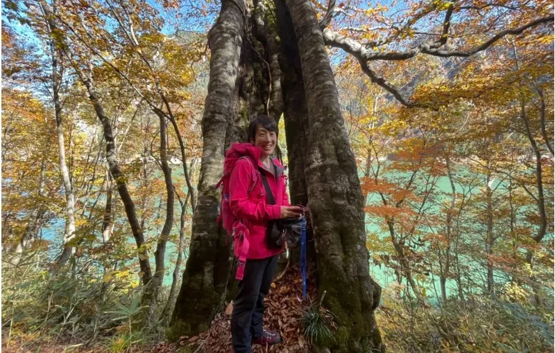
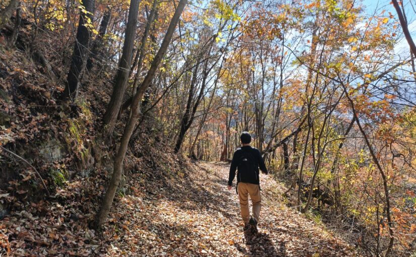
Click here to see the ranking of popular plans in Nagano
Basics of Mountain Climbing and Hiking in Kamikochi
Directions, Seasons, and Map
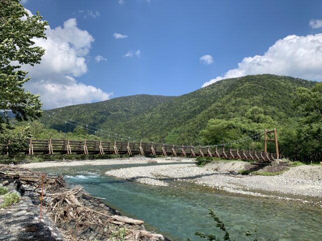
Kamikochi is a region that stretches across an elevation of approximately 1,500 meters,The Gateway to the Northern AlpsIt is.
First, let’s cover the three basics of trekking and hiking: how to get there, the best season, and how to obtain a map.
◆Directions: From JR "Matsumoto Station," take the Alpico Kotsu Kamikochi Line to "Shin-Shimashima Station" (about 30 minutes), then transfer to a local bus to the Kamikochi Bus Terminal (about 1 hour)
↓Click here for recommended forest bathing tours in Kamikochi.
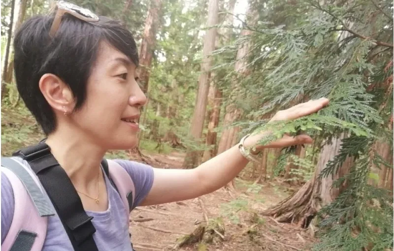
Access to Kamikochi and Private Vehicle Restrictions

To protect the natural environment in Kamikochi,Private vehicles are not permitted.It is.
If you're driving, park your car at the Sawando parking lot on the Nagano Prefecture side or the Akandana parking lot on the Gifu Prefecture side, and then take a shuttle bus or taxi.
If you're using public transportation, it takes about 2 hours to get there by transferring between a train and a bus at Matsumoto Station. If you're planning a day trip on foot, we recommend scheduling your trip so you arrive in Kamikochi early in the morning.
↓Click here for more details on Nagano sightseeing bus tours↓

When Does the Hiking Season Start in Kamikochi? The Best Time to Visit

The season when Kamikochi opens to the public is usuallyFrom mid-April to around November 15That's it. May and June, when the leaves are fresh and green; July and August, which are perfect for escaping the summer heat; and October, when the autumn foliage is beautiful—these months are especially popular!
Due to the high elevation, be mindful of lingering snow and cold mornings in early spring and late fall. For peace of mind, check the official website or other sources for the latest information on trail openings and trail conditions before setting out.
How to Read and Obtain Hiking Trail Maps

Hiking trail maps are available at the information desk at the Kamikochi Bus Terminal and at the visitor center near Kappa Bridge.
There’s also a map on the official Kamikochi website, so be sure to check it out in advance. On the map, the distances between each spot areHiking TimeThe key is to identify the turning point.
Hiking apps on your smartphone are convenient, but since there are places with weak cell service, it’s a good idea to bring a paper map along as well.
↓Click here for more details on the forest bathing tour↓

Day Hiking and Mountaineering Routes in Kamikochi
4 Top Picks

Kamikochi offers a variety of easy-to-hike trails that start at Kappa Bridge and follow the Azusa River.
Here, I’ll introduce four classic hiking trails that even beginners can enjoy on a day trip.
Taisho Pond to Tashiro Pond Course

Taisho Pond is,The 1915 Eruption of Mt. YakeThis pond was formed when the Azusa River was dammed. The view of the dead trees and Mt. Yakedake reflected on the water’s surface is one of Kamikochi’s most iconic sights.
From there, head toward Tashiro Pond along the well-maintained boardwalk and enjoy the scenery of the wetland where spring water flows in. A leisurely walk from Taisho Pond through Tashiro Pond to Kappa Bridge takes about 1 hour and 30 minutes to 2 hours.
Access: a short walk from Kamikochi Bus Terminal
Kappa Bridge to Myojin Pond Trail

This trail starts at Kappa Bridge—the symbol of Kamikochi—and follows the Azusa River toward Myojin Pond. Since you can enjoy views of the Hotaka Mountain Range as you walk, it’s perfect for first-time hikers.
Myojin Pond isHotaka Shrine, OkumiyaLocated within the sacred precincts, this is a mystical spot where Mt. Myojin is reflected in the calm waters. The one-way hike from Kappa Bridge to Myojin takes about an hour; the round trip takes about 2 to 2.5 hours.
Since there's an admission fee for Myojin Pond, it's a good idea to have some change on hand to make things go more smoothly.
Access: 5 min. walk from Kamikochi Bus Terminal
Myojin to Tokusawa-en Trail

Beyond Myojin, the mountainous atmosphere becomes a bit more pronounced, and you’ll spend more time walking through the forest. It takes about 1 hour from Myojin to Tokusawa, and about 2 hours from Kappa Bridge.
Our destination, Tokusawa-en, is a long-established mountain inn nestled in a spacious meadow, andSoft-Serve Ice CreamThis is a local specialty. The round-trip hike from Kappa Bridge takes about 4 hours, so it’s recommended for those who are used to hiking.
Access: 1 hour walk from Kamikochi Bus Terminal
Tokusawa-en to Yokoo Course
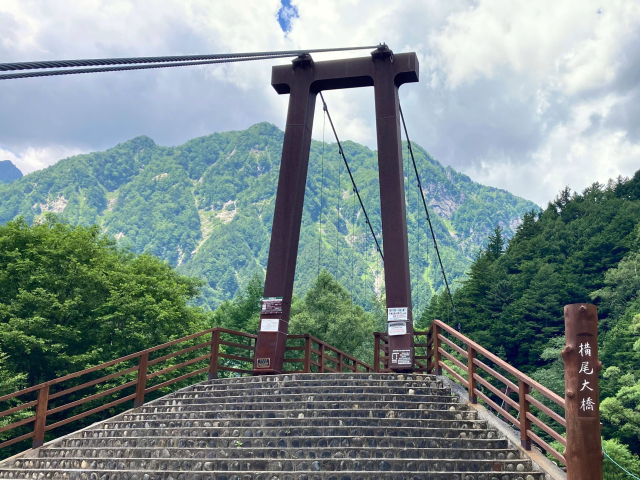
The hike from Tokusawa-en to Yokoo takes about an hour. From Kappa Bridge to YokooAbout 6 hours round tripBecause of this, this course is designed for those who want to take a brisk walk.
Yokoo is located at the junction of the hiking trails leading to Karasawa, Mt. Yarigatake, and Mt. Chogatake, and is home to the Yokoo Bridge and a mountain lodge. Be sure to check the last bus departure time in advance and allow plenty of time before heading back.
Directions: About a 3-hour walk from the Kamikochi Bus Terminal
For Those Who Want to Tackle Karasawa Cirque and Mt. Yakedake
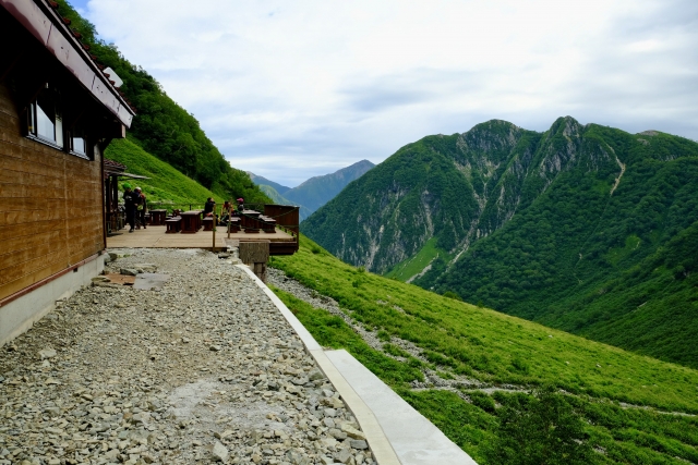
Once you've gotten used to trekking and hiking, why not try your hand at some serious mountaineering?
Here, we’ll discuss the difficulty levels and precautions for the popular Karasawa Cirque and Mt. Yakedake.
↓Click here for details on recommended tours for beginners through advanced travelers↓
The Charms of Karasawa Cirque and Hiking Times
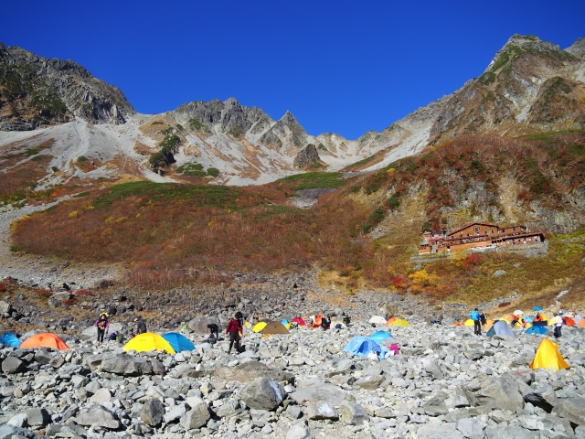
Karasawa Cirque is a massive, bowl-shaped landform carved out by a glacier, with an elevation ofApproximately 2,300 metersThat's right. The dynamic scenery surrounded by the Hotaka Mountain Range is unforgettable once you've seen it.
In particular, the fall foliage is among the most beautiful in Japan, and every yearLate September through early Octoberis said to be at its best. The hike from Kamikochi to Karasawa takes about 6 to 7 hours.
Is it possible to visit Karasawa Cirque on a day trip?
It's possible to do this as a day trip, but the round trip takes12 hours or moreBecause of this, you need both physical stamina and experience.
If this is your first time, consider a plan that includes a one-night stay at a mountain hut, such as Karasawa Hutte or Karasawa Koya. Reservations are required in advance, and these huts fill up quickly—especially during the fall foliage season.
Difficulty Level and Precautions for Climbing Mt. Yakedake
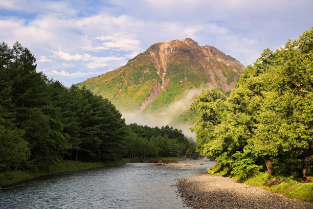
Yakedake has an elevation of2,455 mIt is an active volcano, and you can see steam rising near the summit. It’s a popular destination for serious hikers near Kamikochi, but depending on the route, the round trip takes about 6 to 8 hours.
With many steep slopes and rocky areas, this trail is suitable for intermediate hikers. Be sure to check announcements from the Japan Meteorological Agency and local authorities for information on volcanic gases and mountain access restrictions before setting out.
Tips for Beginners Climbing Mt. Yakedake
For beginners,Leaving early in the morningAs a general rule, you should head down the mountain before the weather turns bad in the afternoon.
On trails with loose rocks, watch your step—it’s a good idea to wear hiking boots and bring a helmet for added safety. If you’re unsure, we recommend choosing a tour led by an experienced guide.
Tours for Beginners: What to Wear and What to Bring
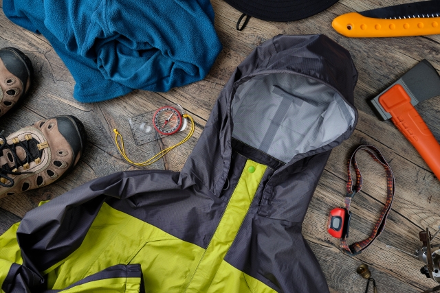
To enjoy Kamikochi safely, it’s important to take a guided tour and make sure you have the right gear for the season.
Here, we've put together some key points about clothing and what to bring that beginners should know.
Benefits of Guided Tours for Beginners in Kamikochi
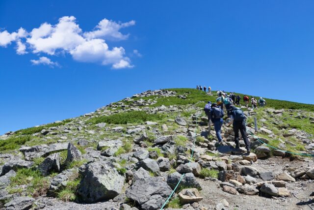
If you're taking a guided tour,Worrying about getting lostOne of its appeals is that there isn't much traffic, so you can walk with peace of mind. As you walk, you can listen to stories about Kamikochi's nature, history, plants, and wild birds, which makes the scenery even more enjoyable.
Since you can leave bear safety precautions and weather assessments to the guide, these tours are especially recommended for first-time hikers and trekkers. Depending on the tour, transportation and equipment rentals may be included.
Clothing for Hiking in Kamikochi (by Season)

Kamikochi is higher in elevation than the lowlandsAbout 5 to 10°CTemperatures are low, and even in summer, it feels chilly in the mornings and evenings. The standard outfit consists of quick-drying base layers topped with a lightweight fleece or windbreaker.
In the spring (mid-April through May) and fall (October and later), be sure to bring warm clothing such as a down jacket, gloves, and a hat.
The sun is strong in the summer, so don't forget to bring a hat and sunscreen. We recommend wearing comfortable hiking shoes.
Packing Checklist
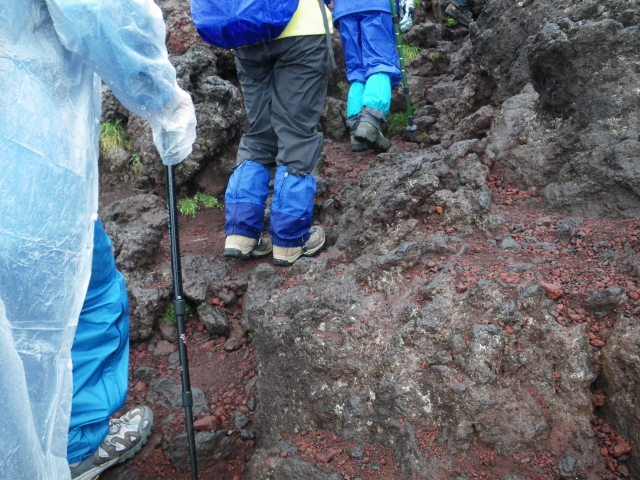
First, you'll want to prepare:Two-piece rain gearThese four items are drinks, snacks, and a map. It’s also a good idea to bring a headlamp, a first-aid kit, a portable charger, and sunscreen.
Since there have been reports of bear sightings in Kamikochi,Bear BellBe sure to bring some with you. It’s also handy to bring some small change, such as 100-yen coins, for the restroom fee.
↓If you're a beginner or intermediate learner, we also recommend this plan↓
Information on Mountain Climbing and Hiking in Kamikochi
Frequently Asked Questions (FAQ)
Yes, you'll enjoy it. There are plenty of flat, easy-to-walk hiking trails, such as the Taisho Pond to Tashiro Pond trail and the Kappa Bridge to Myojin Pond trail.
If you're feeling nervous, you'll feel more at ease if you take a guided tour for beginners.
The mountain is typically open from mid-April through around November 15. It is especially popular during May and June, when the foliage is fresh and green; July and August, when the weather is cool; and October, when the leaves change color.
Since it can still be cold and there may be lingering snow in early spring and late fall, be sure to bring warm clothing.
The basic layering approach is to wear a quick-drying base layer under a fleece or windbreaker. We recommend wearing hiking shoes.
Since temperatures in Kamikochi are lower than at sea level, be sure to bring a light jacket for the mornings and evenings, even in summer.
summary

Kamikochi offers everything from flat trekking and hiking trails suitable for beginners to mountaineering on Karasawa Cirque and Mt. Yakedake,Based on your levelIt's a mountain resort where you can have a great time.
The mountain is typically open from mid-April to around November 15, offering different views with each season—from fresh greenery in spring to summer and fall foliage.
Start with a day trip, and if you're feeling unsure, consider joining a guided tour.
↓Click here to read the article.